(July 10, 2025)—At the field school, we get to experience three different areas of archaeology during our weekly workday rotations: archaeological survey, experimental archaeology, and museum work. My first workday rotation experience was learning how to survey. I will admit that when I read about what surveying required, I was a bit nervous, especially about waking up so early in the morning, but I soon realized that surveying is a lot of fun.
Four out of the five days of my survey rotation, my group and I spent time on a Pleistocene terrace along the Gila River. We would start the work days off by getting into a line, with each of us about fifteen meters (50 feet) away from one another. First we took bearings on our compasses in order to walk in a specific direction. Then we would slowly walk across the landscape, dodging shrubs and ant hills, while our eyes combed the ground for any sign of pottery sherds, lithics (flaked stone), and historic artifacts. When we eventually came across an artifact, we placed pin flags into the ground and continued searching until we reached the end of our designated survey area (in this case a property boundary line). Once we reached the boundary line we turned around and started the line-up process again before searching the desert for more artifacts.
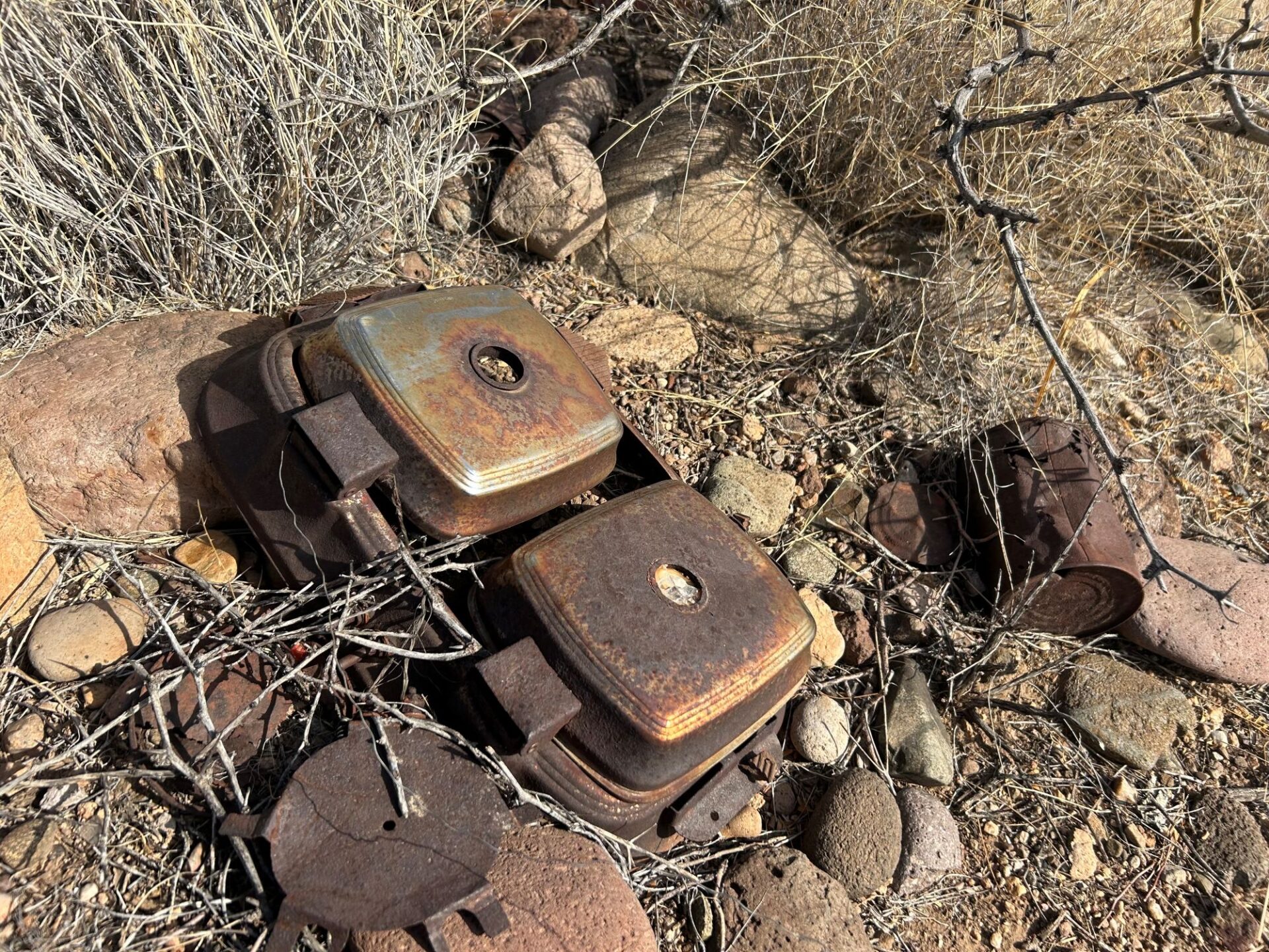
During our survey we recorded a cluster of historic artifacts, which consisted of shards of glass—beverage bottles and some decorative glass pieces—and metal cans. The most interesting historic item in this artifact scatter was a waffle maker!
On survey we also came across numerous stone flakes. These included primary flakes, which are flakes with 100% cortex (visible as an outer layer or “skin” on the outside of the rock, also called the dorsal side); secondary flakes (flakes with some of the cortex remaining); and tertiary flakes (flakes without any remaining cortex). We found flakes of several different material types, including basalt and rhyolite, and smaller quantities of obsidian, chert, and chalcedony.
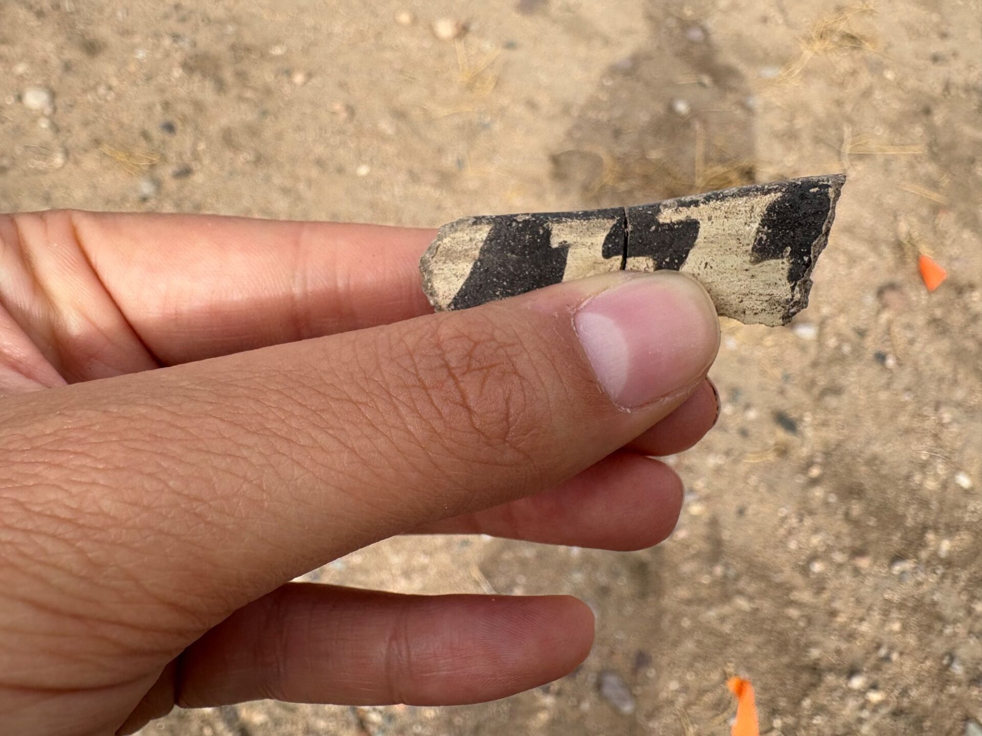
These flakes and historic artifacts were interesting, but my favorite artifacts had to be the pottery sherds. During our five days of our survey, we recorded hundreds of sherds. Corrugated brown plainware, Mimbres Black-on-white style l (750–900 CE), Mimbres Black-on-white ll (880–1020 CE), and Mimbres Black-on-white style lll (1010–1130 CE) were among the most common sherd types that were at the sites we located. San Francisco Red and Three Circle (730–770 CE) were also present, but not as common. These two types are older than the others we observed.
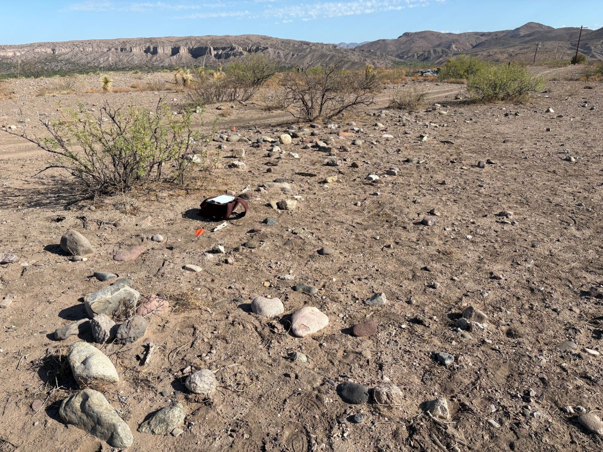
During one of my last days on survey, I had the opportunity to make a sketch map of one of the room blocks our group encountered. Although we normally use a GPS on survey, sketch maps made using a compass are another way to map sites. In order to locate each corner of the room block in space, I stood at a specific spot outside of the room block, and designated this location as my datum. From the datum, I would point my compass towards the corner of an ancient masonry room to get my bearing, then count the number of steps it took to get to that corner. Because the room block I mapped was missing its fourth wall, I needed to get some additional boundary points for that area. To do this, I used the same process but measured points around the perimeter of the room area until I was back at my starting point or datum.
At the end of the week, we went down to the river to check over our maps and other documentation, and finished the day and our week of survey by completing all the New Mexico state site forms and accompanying information for the sites our group recorded.