• Donate
    • Donate
    • Member Circles and Benefits
    • Become a Member
    • Renew Today
    • Give a Gift Membership
    • Student Membership
  • Take Action
    • Volunteer Program
    • Make Your Voice Heard
  • About
    • Land Acknowledgment
    • What We Do
    • Position Papers
    • Team & People
    • Job Openings
    • Partners & Friends
    • Annual Reports
    • Policies & Financials
  • Things to Do
    • Events
    • Archaeology Café
    • Exhibits
    • Classes
    • Field School
  • Explore
    • Free Resources
    • Introduction to Southwestern Archaeology
    • Projects
    • Protection Efforts
    • Ancient Cultures
    • Videos
    • Places to Visit
  • Store
    • Archaeology Southwest Magazine
    • All Products
  • News
    • Blog
    • Press Releases/Announcements
    • Preservation Archaeology Today
    • Sign up for E-News
  • Donate
    • Donate
    • Member Circles and Benefits
    • Become a Member
    • Renew Today
    • Give a Gift Membership
    • Student Membership
  • Take Action
    • Volunteer Program
    • Make Your Voice Heard
X
  • About
    • Land Acknowledgment
    • What We Do
    • Position Papers
    • Team & People
    • Job Openings
    • Partners & Friends
    • Annual Reports
    • Policies & Financials
  • Things to Do
    • Events
    • Archaeology Café
    • Speakers Bureau
    • Exhibits
    • Classes
    • Field School
  • Explore
    • Free Resources
    • SW Archaeology 101
    • Projects
    • Protection Efforts
    • Ancient Cultures
    • Videos
    • Places to Visit
  • Store
    • Archaeology Southwest Magazine
    • All Products
  • News
    • Blog
    • Press Releases/Announcements
    • Preservation Archaeology Today
    • Sign up for E-News

Survey and Mapping

Preservation Archaeology Blog
  • Home
  • >
  • Preservation Archaeology Blog
  • >
  • Survey and Mapping
Sam Rodarte, Cochise College

(June 22, 2018)—Participating in the field school has been a really great experience that I consider myself so lucky to be involved in. I originally got into anthropology because of my interest in different myths from all over the world. I want to be part of the process that brings knowledge about mythology to other people who have an interest in all things mythological in hopes they decide to look into other cultures.

Out here in the field, it is vastly different from reading myths; it’s actual physical labor! One of my favorite activities that we’ve learned so far was archaeological surveying. Survey is us going out onto the land and looking for any sign of archaeological sites. This includes things like pottery pieces (which we call sherds) and stones that have been worked into tools or points (which we call flaked stone). At first it was difficult to distinguish the flaked stone from regular rocks, but after a while we got the hang of it.

One of the more noteworthy events that happened to my survey partner Constance and me during the survey was finding an ancient masonry pueblo! Sadly, there was evidence it had been looted, and much of it was badly disturbed. The site was still noteworthy, though, and it was extremely exciting to be able to come across a building many centuries old.

Max helps us locate our position on a topographic map.

Filling out forms to record archaeological site information.

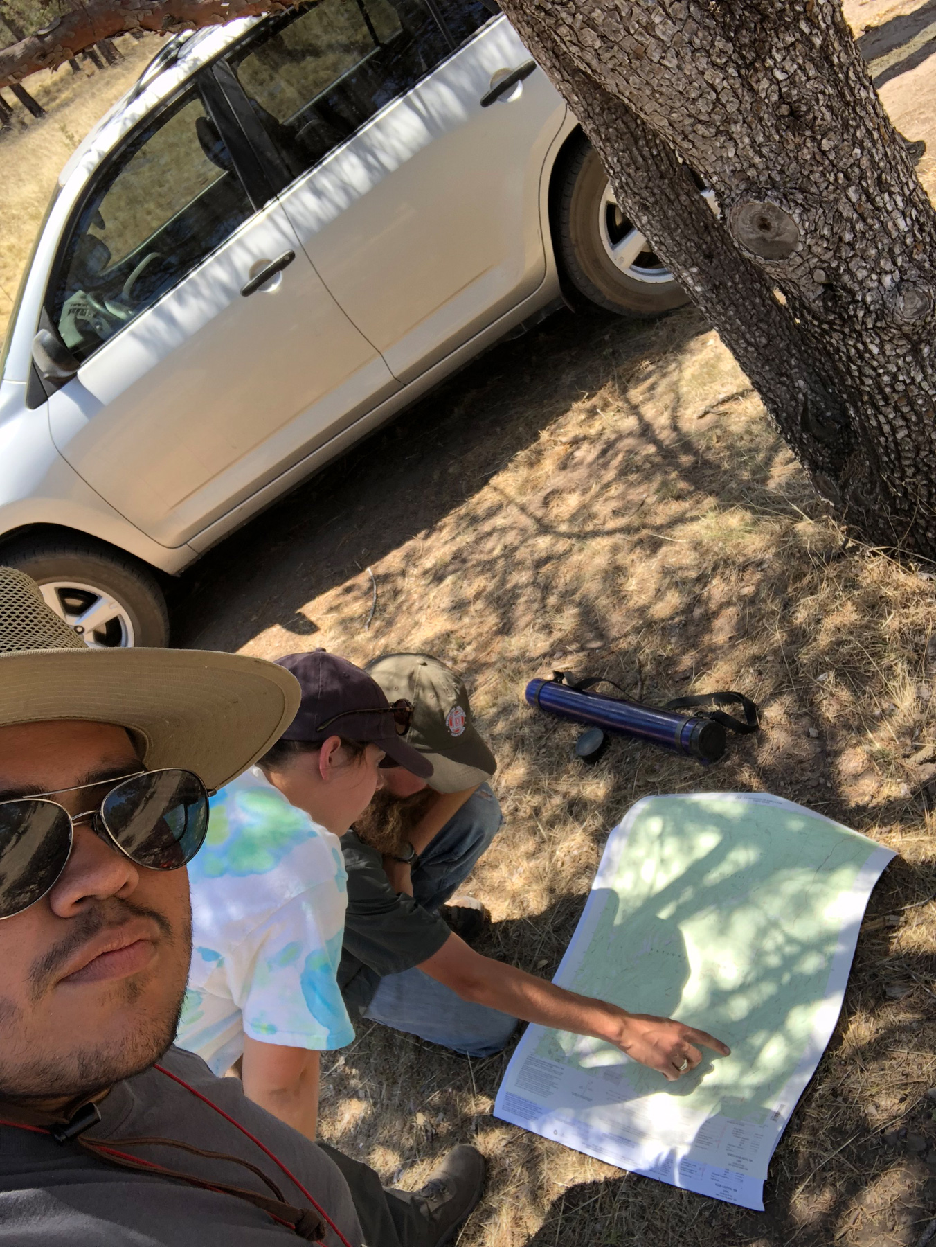
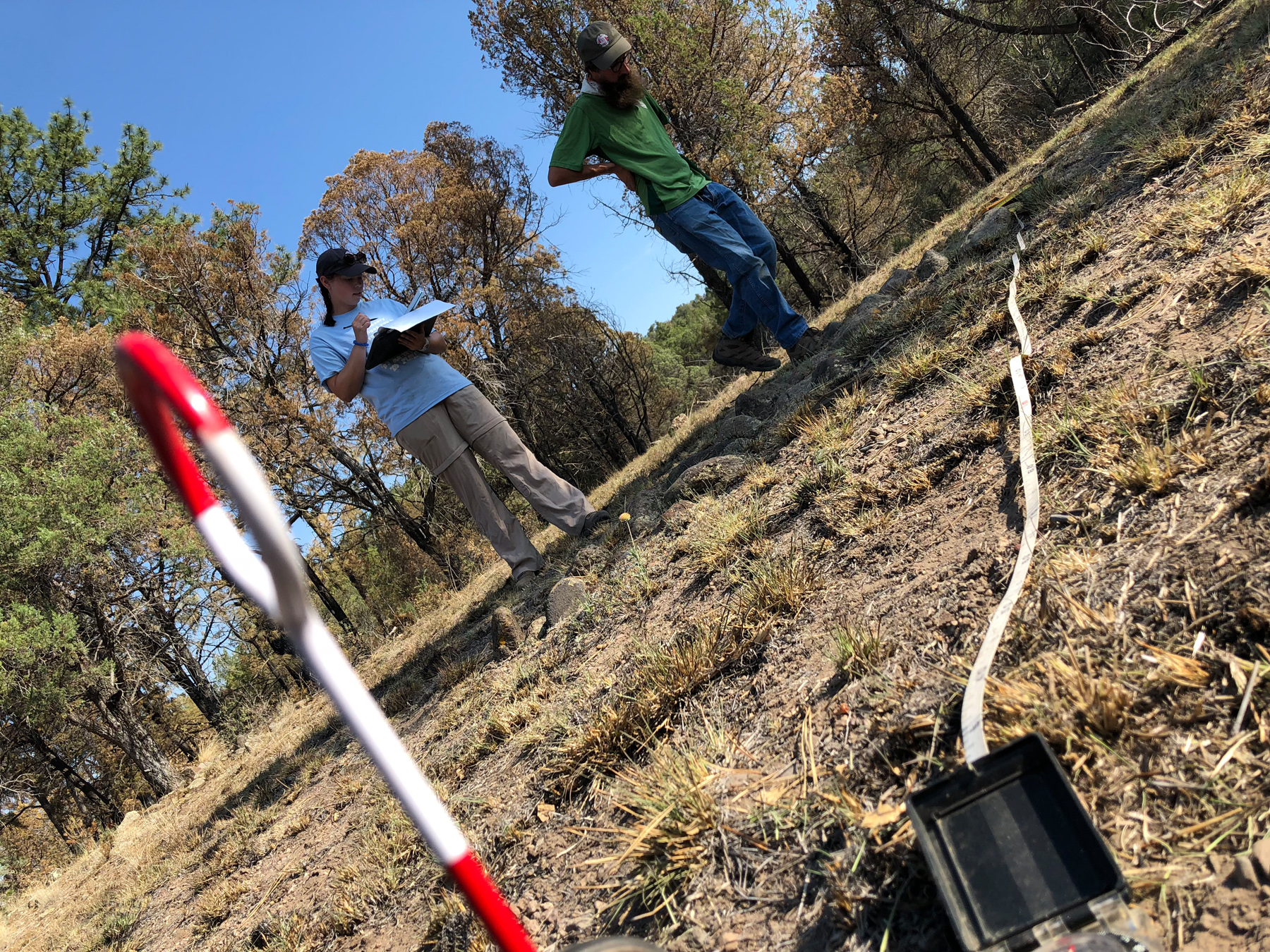
Our survey instructor, Max, showed us what procedure to follow when finding and recording a site. First, when we arrive at an area to look for sites, we line up and walk transects, looking for artifacts on the surface. Then, we find the boundary of the site by fanning out and locating the furthest artifacts. Once we locate the site boundaries, we make a map of the site. We learned two ways to map: with the more modern technique using a highly accurate device called a Trimble (a handheld GPS unit), as well as an old-school mapping method using tape-and-compass. The older method is a great thing to know because if technology fails, you can still map using the original technique.

Mapping an archaeological site using a tape and compass.

After we map sites and record other information about them, landowners may use this information to make better decisions about how to preserve the sites they own or manage. That’s a topic for another blog post!

Explore the News

  • Preservation Archaeology Blog
  • Press Releases/Announcements
  • Preservation Archaeology Today
  • Join Today

    Keep up with the latest discoveries in southwestern archaeology. Join today, and receive Archaeology Southwest Magazine, among other member benefits.

    Become A Member

Want to help us? Make a donation

or take action

Cyber SouthwestRespect Great BendHands-On ArchaeologySave History

© 2025 Archaeology Southwest

520.882.6946
Contact
  • My Store Account
  • Contact Us
  • Terms of Use
  • Privacy Policy
  • Press Room