Evan Giomi, Survey Director, University of Arizona
(June 27, 2016)—Archaeological survey is the activity of locating, identifying, and recording archaeological sites to build a record that can be later used by archaeologists looking to put shovels in the ground or monitor any damage to the sites by vandalism or natural processes, like erosion. Although it is important to teach students the methods and techniques of archaeological survey—including use of navigation and mapping equipment like compasses, GPS devices, and topographic maps—survey is also a great time to teach them about the wider landscape of New Mexico. Knowledge of the natural landscape past people lived on is important for successfully finding archaeological sites.
Survey is an opportunity to introduce students to common flora and fauna of New Mexico. The abundance of deer, cottontail, jackrabbits, and quail alongside state highways underscores the value of these animals as a possibly rich food source for past people. Although it is important to introduce students to iconic plants of New Mexico—such as cottonwood, juniper, chollas, prickly pear, yucca, and mesquite, so that they can fill out the state forms used to record archaeological sites—it is even more important to introduce them to these plants so that they understand how they were valued as resources by past people.
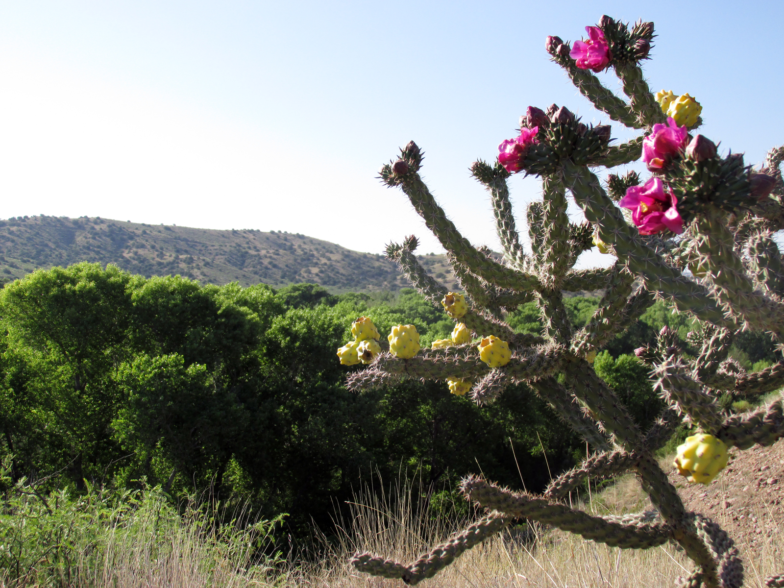
Cottonwood and juniper provided logs for building homes, whereas cactus fruits and mesquite pods were valuable foods in the parts of a desert environment unsuitable for farming. Understanding the distribution of different species across the landscape helps us interpret the archaeological record. For instance, students excavated roof beams at an archaeological site located in the flood plain of the Gila River and expect to find cottonwood rather than higher elevation pine and juniper.
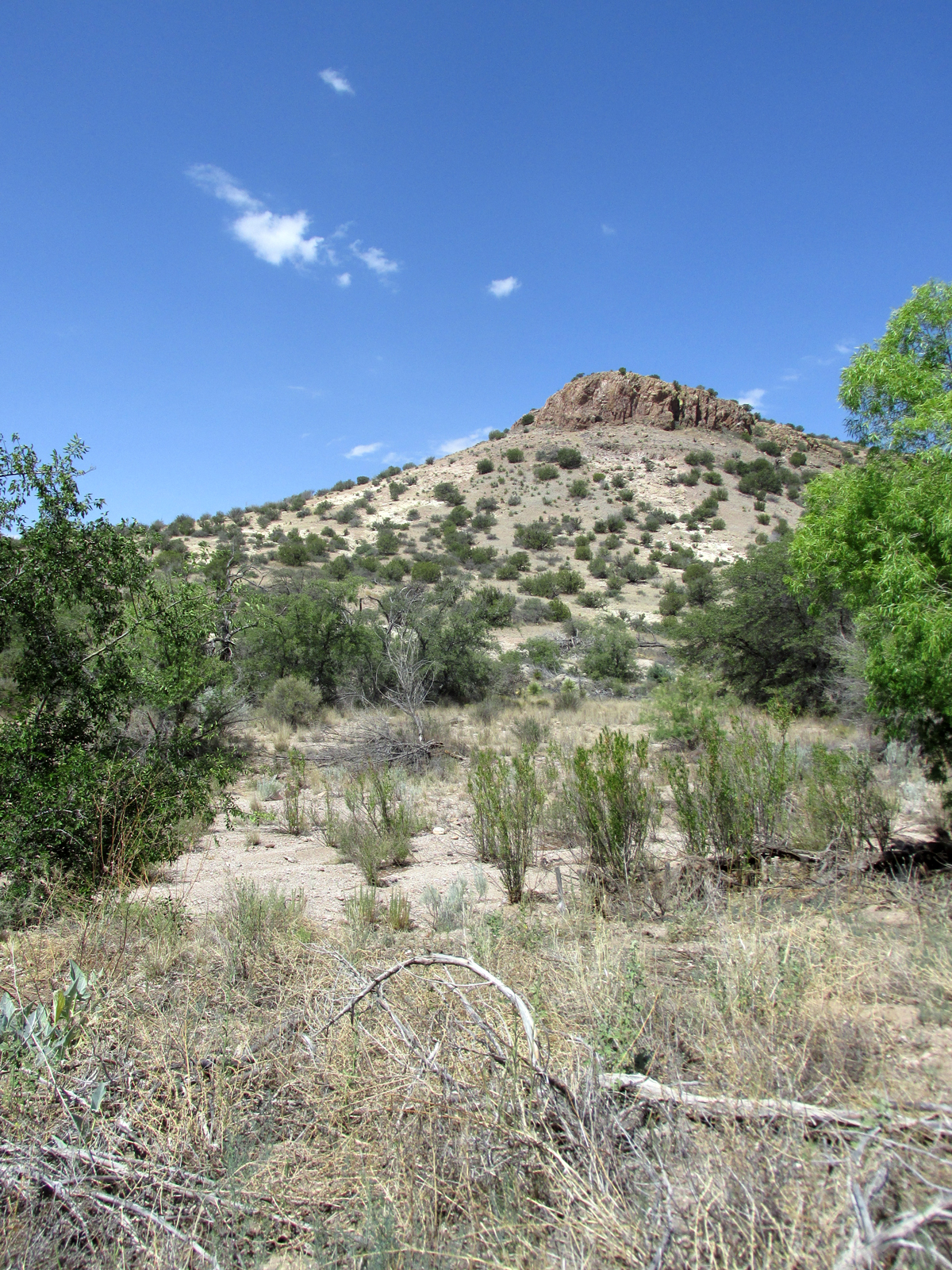
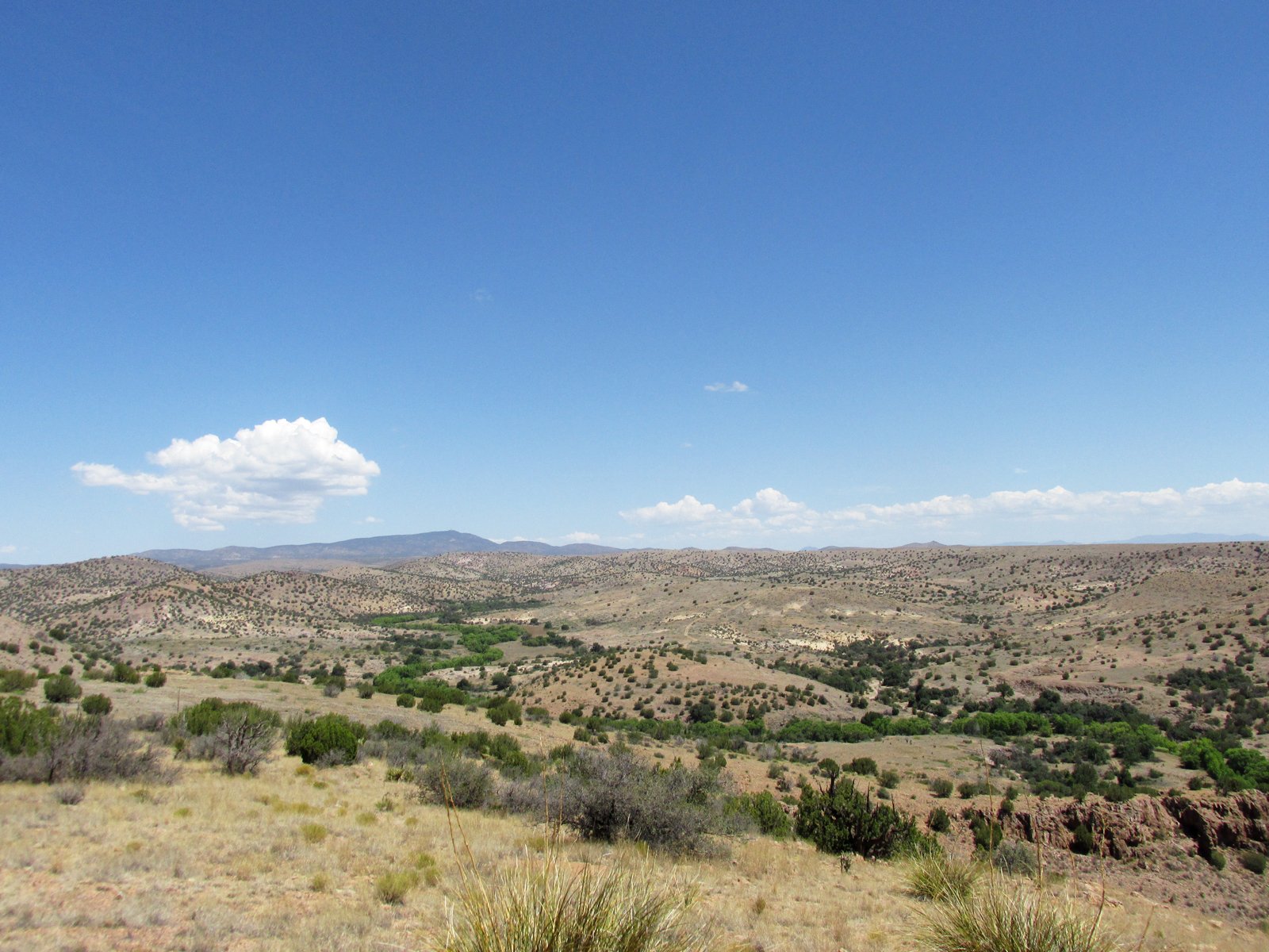
Surveying large tracts of land also provides an opportunity to familiarize students with different geographic features in the Southwest. Knowing about river valleys, mesa tops, rolling hills, river terraces, and arroyos is important for locating archaeological sites. Flash floods and annual flooding in river valleys and arroyos makes them poor choices to build a home, but great places to farm. The often steep slopes of hill and mountain sides are good locations for finding raw stone for making tools, but difficult to build on. In contrast, flat mesa tops and river terraces are ideal locations to build architecture. River terraces are not susceptible to flooding, but are still located near water sources, whereas mesa tops are ideal defensive positions in troubles times.
Locating water on the landscape is particularly important for identifying archaeological sites in the desert Southwest. Water is the best indicator of archaeological sites, providing drinking water, unique floral and faunal communities, and building resources, including water for producing adobe mud and wood. Water can drastically alter both plant and animal communities, providing a greater diversity of potential food resources. All these factors mean that archaeological sites are most commonly located on geographic features such as benches, which provide ready access to a wide variety of natural resources.
The key to effectively identifying the location of archaeological sites through survey is understanding the landscape past people lived in and how they valued different natural resources and geographic features.