• Donate
    • Donate
    • Member Circles and Benefits
    • Become a Member
    • Renew Today
    • Give a Gift Membership
    • Student Membership
  • Take Action
    • Volunteer Program
    • Make Your Voice Heard
  • About
    • Land Acknowledgment
    • What We Do
    • Position Papers
    • Team & People
    • Job Openings
    • Partners & Friends
    • Annual Reports
    • Policies & Financials
  • Things to Do
    • Events
    • Archaeology Café
    • Exhibits
    • Classes
    • Field School
  • Explore
    • Free Resources
    • Introduction to Southwestern Archaeology
    • Projects
    • Protection Efforts
    • Ancient Cultures
    • Videos
    • Places to Visit
  • Store
    • Archaeology Southwest Magazine
    • All Products
  • News
    • Blog
    • Press Releases/Announcements
    • Preservation Archaeology Today
    • Sign up for E-News
  • Donate
    • Donate
    • Member Circles and Benefits
    • Become a Member
    • Renew Today
    • Give a Gift Membership
    • Student Membership
  • Take Action
    • Volunteer Program
    • Make Your Voice Heard
X
  • About
    • Land Acknowledgment
    • What We Do
    • Position Papers
    • Team & People
    • Job Openings
    • Partners & Friends
    • Annual Reports
    • Policies & Financials
  • Things to Do
    • Events
    • Archaeology Café
    • Speakers Bureau
    • Exhibits
    • Classes
    • Field School
  • Explore
    • Free Resources
    • SW Archaeology 101
    • Projects
    • Protection Efforts
    • Ancient Cultures
    • Videos
    • Places to Visit
  • Store
    • Archaeology Southwest Magazine
    • All Products
  • News
    • Blog
    • Press Releases/Announcements
    • Preservation Archaeology Today
    • Sign up for E-News

What I’m Doing This Week: Doug Gann

Preservation Archaeology Blog
  • Home
  • >
  • Preservation Archaeology Blog
  • >
  • What I’m Doing This Week: Doug Gann
Doug Gann, Preservation Archaeologist and Digital Media Specialist
Doug Gann

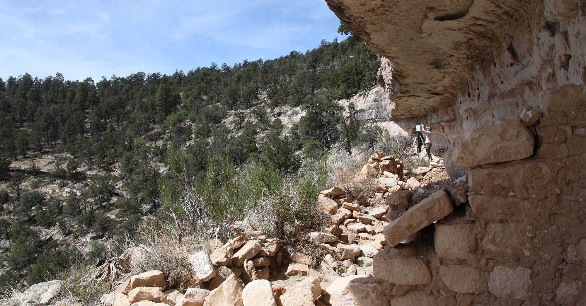
This week’s tasks involve all my favorite things: ancient architecture, 3D modeling, Autocad, LIDAR scans and photogrammetry. Through the Colorado Plateau Cooperative Ecosystem Study Unit (CESU), I’ve been tasked with digitally documenting three backcountry cliff dwellings near Flagstaff at Walnut Canyon National Monument. I’ve done plenty of architectural documentation in the field, but this is the first time we have tried using GPS, LIDAR, and photogrammetry to completely document ancient places. In this task, I’ve been assisted by LIDAR guru Katie Simon from the Center for Spatial Technologies, Chief Cartographer Michael Brack from Desert Archaeology, Inc., and my colleague Paul Reed (Archaeology Southwest).

Another day at the office. Katie Simon is preparing the first of 16 laser scans of this ancient cliff dwelling.

The 3D data, collected during a few field trips between 2012 and 2014, are coming together now in 3D models that can be used for detailed architectural documentation.

LIDAR scan data. Every rock, every surface, every tree, every bush, recorded and geolocated to around 15 millimeter accuracy.

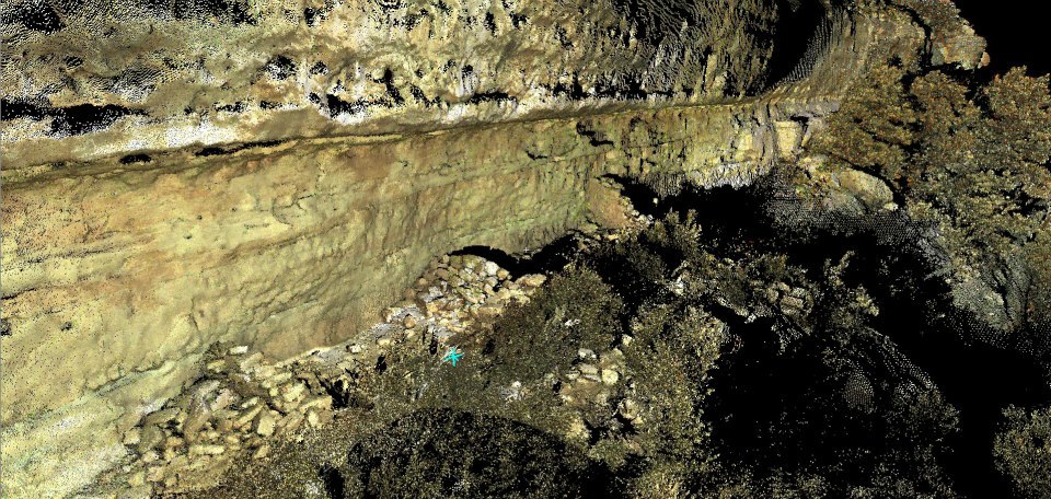
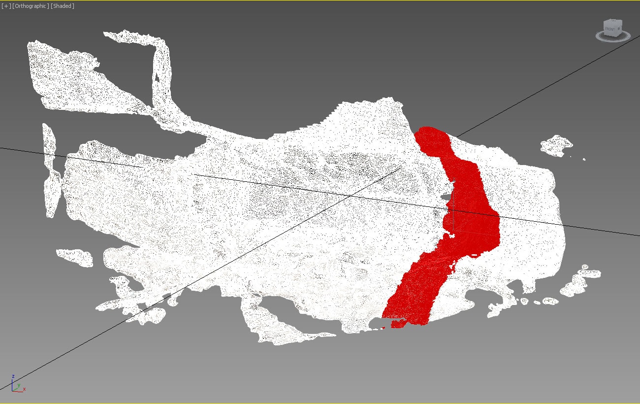
The LIDAR results are mind boggling. Normally when I work with 3D models, I have to deal with a lot of missing data; here, dealing with millions of X, Y, Z points, managing the data overload seriously taxes even the most powerful desktop computers.

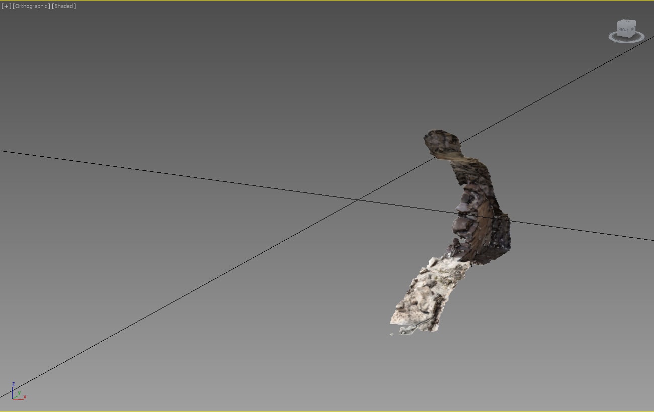
Unfortunately, the next two cliff dwellings were built in settings too steep to risk carrying a fragile, $200,000, 60-pound optical LIDAR scanner, so we decided to use terrestrial photogrammetry to model these places. Photogrammetry works by extracting three-dimensional data from sets of overlapping photographs. The photogrammetry process, in this case, uses a program called Photoscan, available from www.agisoft.ru.

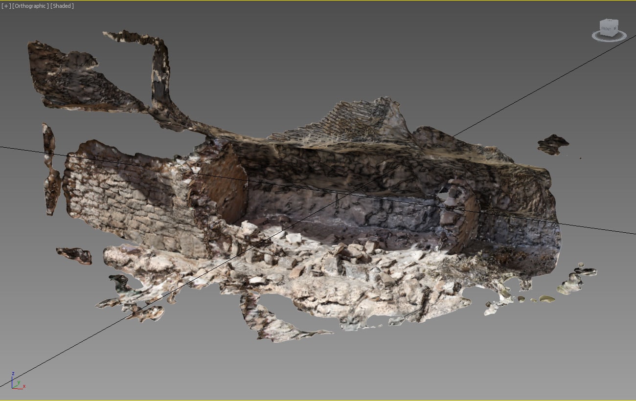
Photoscan is amazing, vexing, tricky, and sometimes difficult to manage, but when it works, it is a thing of mapping beauty. In the case of the cliff dwellings at Walnut Canyon, we have found that Photoscan is most easily used to model smaller parts of the dwellings and then assemble these elements into a complete site model once all of the parts are accurately recorded.

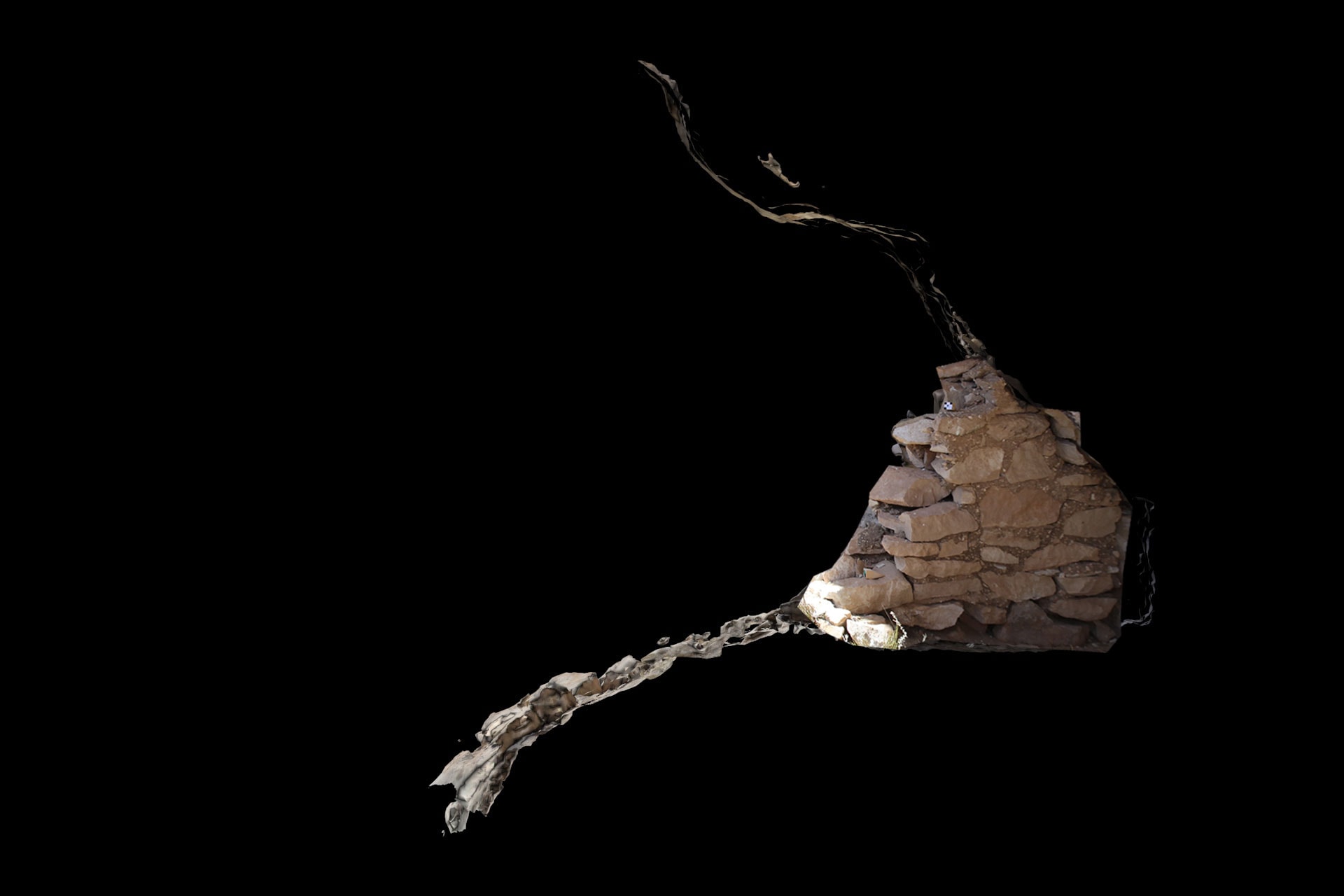
The video above shows a model of room 2, and the front wall of room #1 of a backcountry cliff dwelling in Walnut Canyon National Monument. Once the model has been double-checked against numerous measurements made inside the cliff dwelling, I then take the resulting model and use Autocad to draft traditional plan and profile views.

A profile view of room 2 overlain with Autocad drafting.

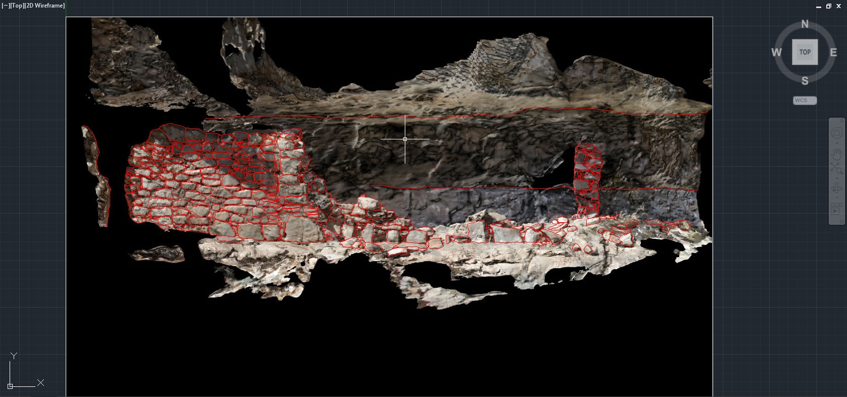
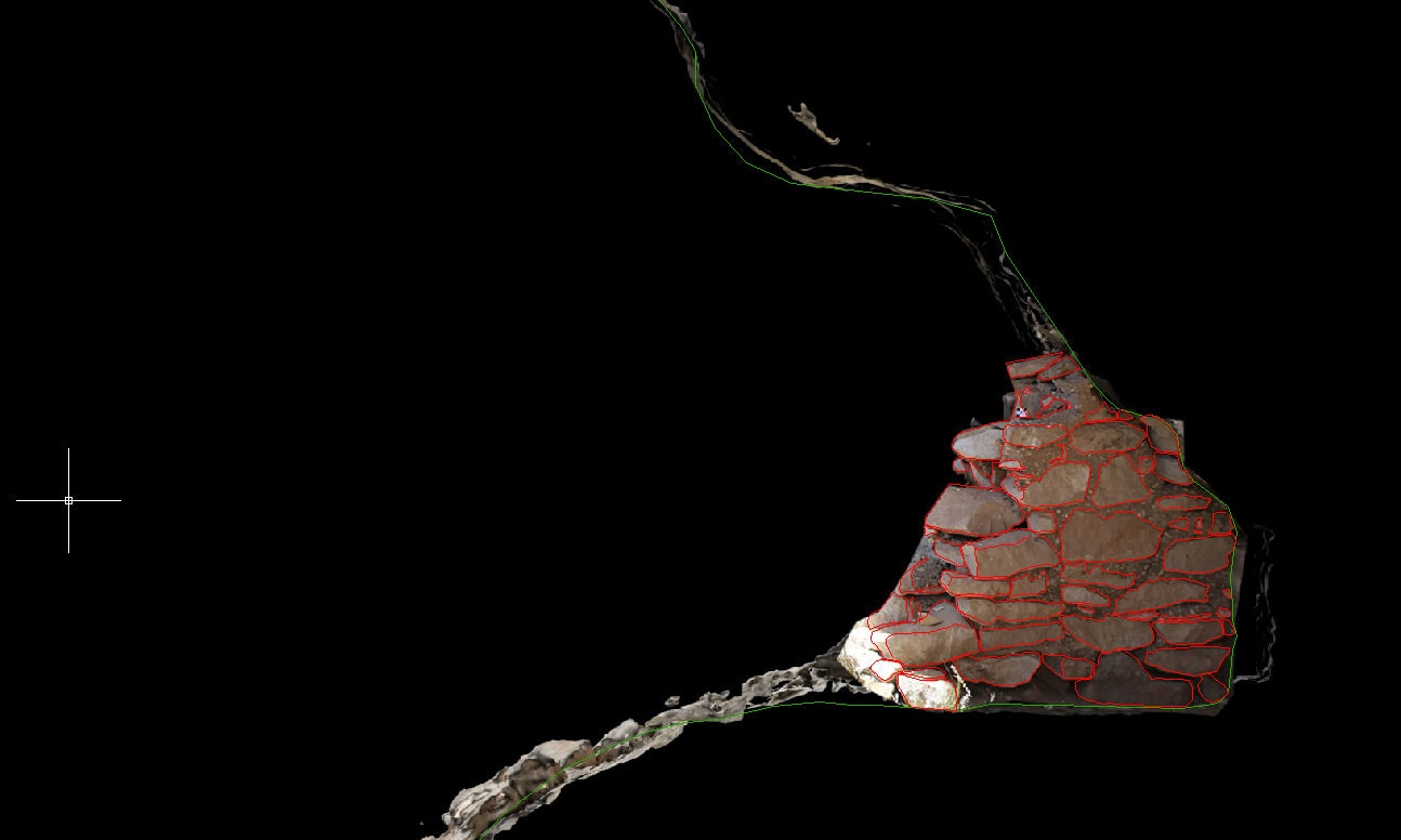
Drafting on top of 3D plots like the example above is fairly easy, but getting into the model and trying to draft inside a 3D virtual model becomes difficult, again, due to the amount of digital information displayed at once. The solution, in this case, is to slice and dice the model so that you can easily render the data intelligible. In the example below, I want to create a drawing of the southern face of the wall on the right side of the image above.

Full model showing room 2.
Selecting the wall and cross section I need to draft in Autocad.
With the other faces hidden, I can now focus on the wall I need to draw.
Cross section view of selected modeling data
Using Autocad to draft the wall and bedrock cross section for room 2.

And so this is what I’m doing this week. All my favorite tools are all coming together to create a new standard for archaeological documentation. From the research we are doing with 3D documentation here at Archaeology Southwest (and at so many other digitally savvy institutions all over the world), we are incorporating this process into our archaeological practice, and expect to utilize these techniques at our upcoming Preservation Archaeology Field School at Mule Creek this summer.

And if you think this project is interesting, just wait to see what we have recorded at Pecos National Historic Park…

Explore the News

  • Preservation Archaeology Blog
  • Press Releases/Announcements
  • Preservation Archaeology Today

Related to This

  • Location Walnut Canyon National Monumen...
  • Post What We’re Doing This We...

Want to help us? Make a donation

or take action

Cyber SouthwestRespect Great BendHands-On ArchaeologySave History

© 2025 Archaeology Southwest

520.882.6946
Contact
  • My Store Account
  • Contact Us
  • Terms of Use
  • Privacy Policy
  • Press Room