For those of us living in central and southern Arizona, Monday was a record-breaking day of rain. Many parts of the Phoenix metro area received more than 3 to 5 inches within a 24-hour period. To put that in perspective, the Phoenix area typically gets about 9 to 10 inches of rain PER YEAR. Things weren’t quite as extreme for us down in Tucson, but the rapid floods through washes and rivers proved damaging and, unfortunately, deadly in some cases. These kinds of events really highlight how powerful even a few inches of flowing water can be.
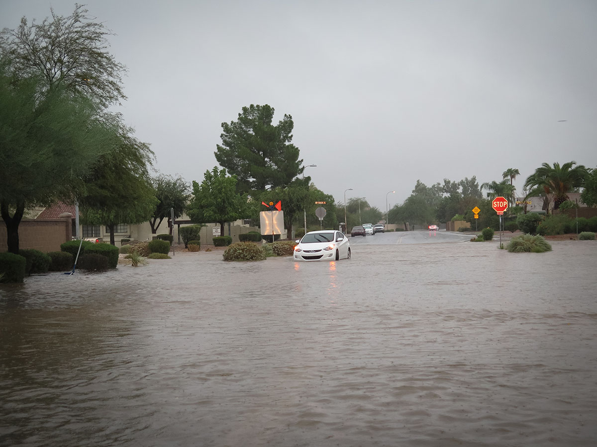
Watching all the footage of the damage caused by these storms and (carefully) driving through it myself on the way home from the office, I started thinking about how such events may have impacted the lives of people living here in the past. People have been farming the floodplains and bajadas of southern Arizona and other parts of the Southwest for more than 4,000 years. Often, when archaeologists talk about rainfall in the desert Southwest, we talk about scarcity. How were people able to grow food with what little rainfall they did get? How did they capture water and divert it to their agricultural fields? Studies of ancient agricultural practices in the southern Southwest reveal that farmers in the region were incredible canal engineers (Hohokam irrigation farmers in the Phoenix area created more than 500 miles of canals, some spanning more than 20 miles) and were adept at placing fields and water diversion features to take advantage of runoff. Indeed, Hohokam farmers depended on summer flash floods, coming with the monsoon rains, to provide water to their fields during the growing season. Storms the likes of which we saw on Monday, however, may have proved disastrous.
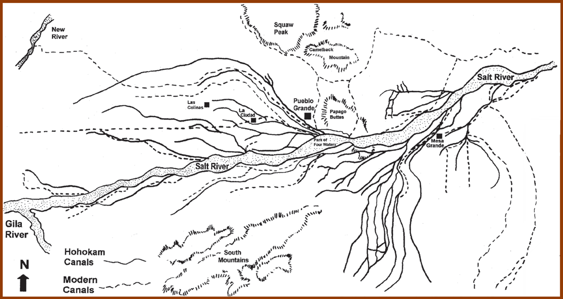
Several archaeologists working in southern Arizona have suggested that unusually large floods may have been a big problem for farmers relying on canal irrigation, as they could have damaged canal infrastructure and required substantial repairs, or even could have damaged stream channels irreversibly. In certain circumstances, archaeologists can use paleoenvironmental data to estimate when such damaging floods may have been likely. For example, archaeologist Donald Graybill and others in the 1980s and later used tree-ring widths (which provide an indication of how much water was available for a tree in a given year) from the upper reaches of the Salt River watershed to identify years that were probably marked by particularly heavy rains and heavy stream discharge. The Salt River supplied water to the largest Hohokam irrigation systems in the Phoenix Basin. Graybill and his colleagues found that the mid-fourteenth century was probably characterized by several catastrophic flood events the magnitude of which had not been seen for more than 500 years, followed by years of low flow. Such a pattern may have been particularly damaging, causing downcutting and other changes to the stream channel, and making it harder for farmers to draw off water for irrigation. Although there are certainly complexities with this model and dissenting opinions, many archaeologists have argued that the damage caused by such major flooding in the fourteenth century may have contributed to the eventual demise of the large-scale irrigation systems constructed in the Phoenix Basin and elsewhere. Interestingly, O’odham traditional histories include references to such severe floods and the environmental degradation that they can cause.
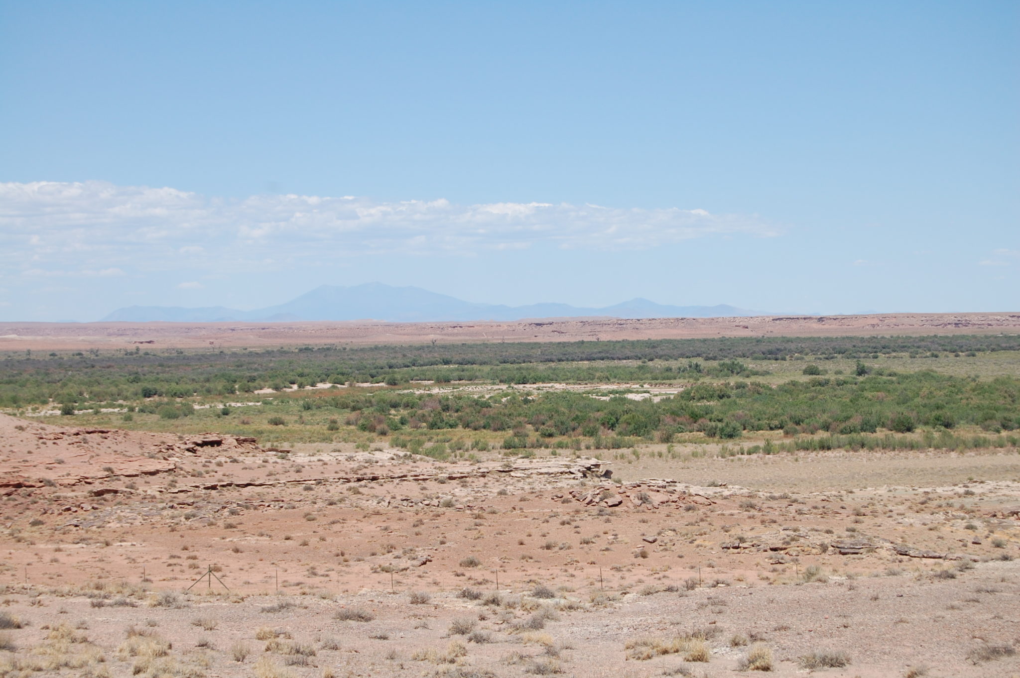
To the north, on the Colorado Plateau, we also have evidence of how flooding may have affected people in the past (for good and for ill). One excellent example is the Homol’ovi area, including Homol’ovi State Park and surrounding areas. During the late thirteenth and fourteenth centuries, this area was home to a large population living in a series of large, plaza-oriented pueblos, some containing more than 1,000 rooms. Prior to this period, however, populations in the Homol’ovi region were considerably smaller. Archaeologist Chuck Adams has argued that one factor that may have facilitated the population influx into the region was a regional flood. The portion of the Little Colorado River where the Homol’ovi pueblos lie lacks easily obtainable wood resources (both construction materials and fuel). While Adams and his team were working at Homol’ovi in 1993, an enormous flood deposited large amounts of driftwood in the floodplain near the pueblos. This modern flood pushed archaeologists to think about flood events in the past. The driftwood from the 1993 flood was subjected to tree-ring dating, which revealed dates from the nineteenth century all the way to a few years before 1993. These dates tended to cluster around years marked by substantial flood events in the recent past. Examinations of archaeological wood found in the roof construction materials from the Homol’ovi pueblos revealed a similar tendency toward clustering. Based on these similarities, Adams and others hypothesized that a major regional flood event (probably occurring in the last quarter of the thirteenth century) may have brought substantial amounts of usable wood into the Homol’ovi area, perhaps influencing the timing of settlement in this region. Though flooding may have played a role in the establishment of the Homol’ovi cluster, it also may have been a factor in the community’s eventual demise. Environmental reconstructions of the Little Colorado River suggest that massive and possibly catastrophic floods may have occurred in 1382 and 1384, coincident with the depopulation of some of the villages in the area. The floods giveth, and the floods taketh away.
As the examples I cover here suggest, farmers in the Southwest had to worry not only about having enough rain, but also about having too much. People across this region came up with ingenious technologies and strategies for dealing with the unpredictability of rainfall and flooding. Sometimes, though, they must have been overwhelmed by the scale of flood events—as we sometimes are today.
One thought on “Flooding Down in Arizona”
Comments are closed.