On July 2, 2012, Archaeology Southwest accepted the donation of an eight-acre conservation easement that will help to protect a significant portion of the José Solas Ruin, a site in southeastern Arizona’s San Pedro River valley.
Valley resident Daniel Baker donated the easement on a portion of his property. Mr. Baker has helped to secure a number of natural and cultural resource conservation easements in San Pedro’s Cascabel vicinity.
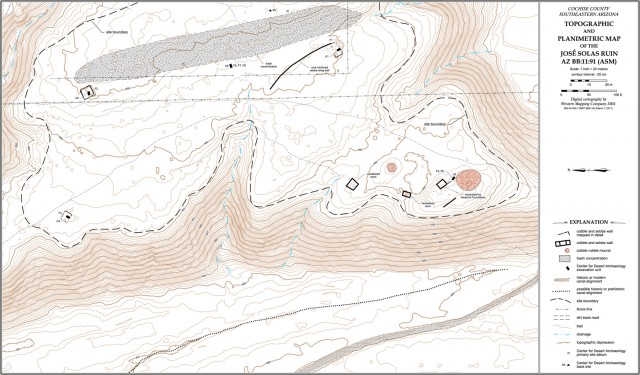
José Solas Ruin comprises a large pre-Classic pithouse settlement that covers much of the site area, a dispersed Soza phase (1200–1275) settlement that overlies and intrudes that earlier village, and a small Redfield phase (1325–1375) Kayenta/Tusayan migrant enclave in the southwestern portion of the site. The latter is not located on the Baker parcel.
In the early 1950s, Charles Di Peso undertook a brief investigation of the site on behalf of the Amerind Foundation. Archaeology Southwest (then the Center for Desert Archaeology) undertook limited excavations at the site in late 2000. Through that work, we learned more about Soza phase architecture and settlement layout. We also confirmed the presence of a migrant community in the fourteenth century.
Although Di Peso had raised the possibility that José Solas Ruin might be identified as a seventeenth-century Sobaipuri site known through documentary evidence as San Salvador de Baicatcan, Archaeology Southwest’s work showed that this could not be the case.
To learn more about archaeological conservation easements, view Archaeology Southwest’s fact sheet here.

Map of José Solas Ruin. Click here for a high-resolution PDF.
