Description
Archaeology at the Gillespie Dam Site: Data Recovery Investigations for the Palo Verde to Pinal West 500 kV Transmission Line, Maricopa County, Arizona (TR2009-6) (PDF)
Data recovery efforts at the Gillespie Dam site involved four primary tasks: identification and study of archaeological remains within the construction staging area of transmission Tower 49 (the area of direct construction impact); investigation of a cobble-walled structure at the edge of the Tower 49 staging area; study of a historic canal, AZ T:14:143 (ASM), at its intersection with a proposed access road extension; and surface inspection of access roads and Tower 49 pulling station areas for archaeological features. The fieldwork also included archaeological monitoring at Palo Verde to Pinal West Towers 48 and 50.
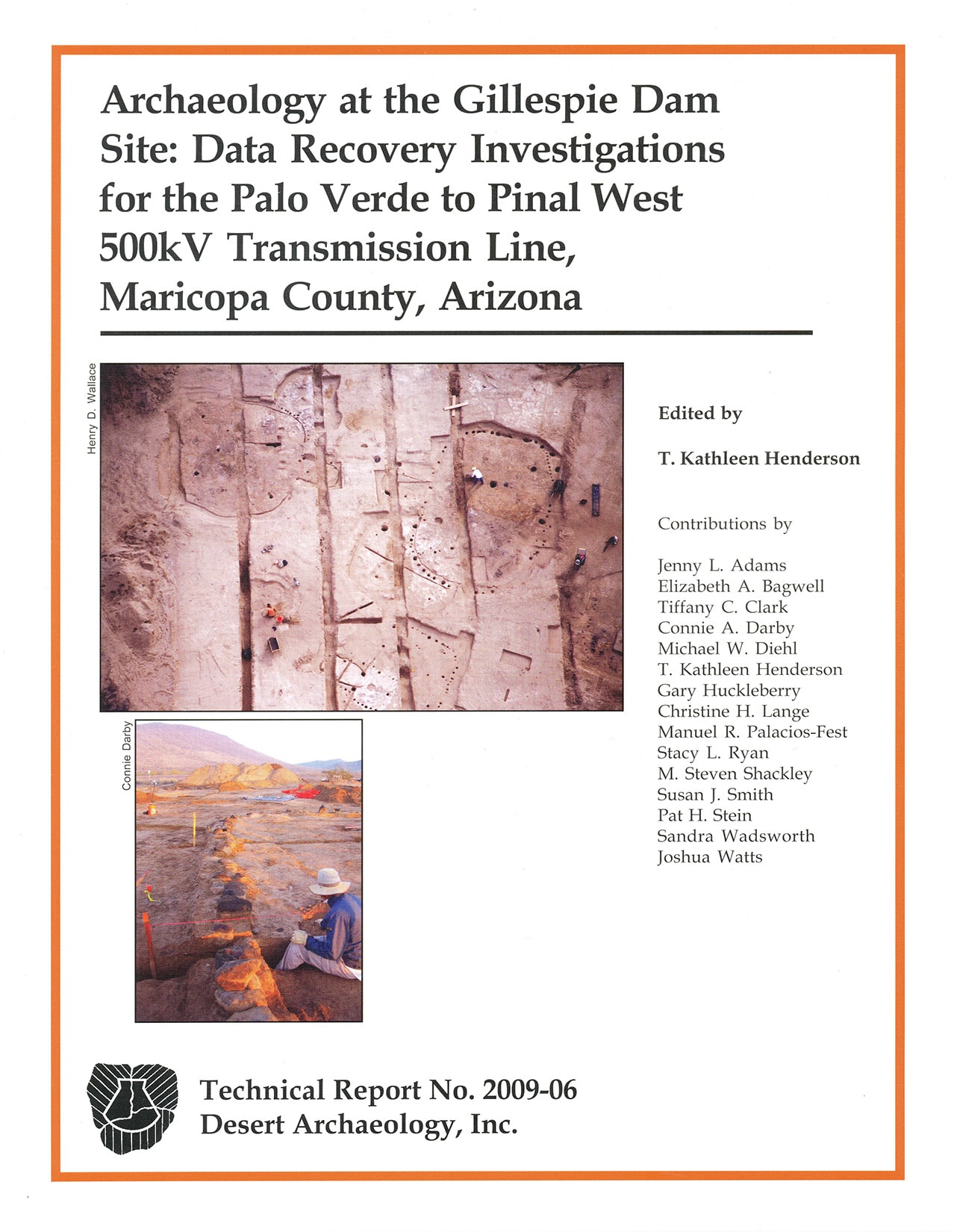
An abundance of prehistoric features was encountered in the Tower 49 construction staging area, including 21 pithouses, 1 cobble-buttressed adobe structure, 2 ramadas, 1 storehouse/granary, 1 prepared extramural surface, 1 trash mound, and various other extramural features such as burned surfaces, non-thermal pits, rock-filled pits, and roasting pits. Three of the pithouses are among the largest ever excavated within the Hohokam cultural area; the adobe structure was also extra-large in size. The excavated area can be characterized as a residential locus within the larger Gillespie Dam village; the large structures imply additional special village functions. The locus was occupied during the Sedentary and early Classic periods, or from the tenth century to sometime after the thirteenth century A.D. Research topics explored by the project include chronology, village organization and activity, subsistence and land use, and cultural affiliation and interaction.
One long backhoe trench was used to sample the historic canal, T:14:143, which skirts the edge of the river terrace scarp in the southwestern portion of the Gillespie Dam site. Archival research identified this channel as the Wolfley Canal or first “Gila Bend” Canal. It was the first of several Historic era canals built on the eastern side of the Gila River north of Gila Bend, Arizona. The Wolfley/Gila Bend canal operated intermittently between 1892 and 1895, and possibly as late as 1905. Study of the Wolfley/Gila Bend canal provided a rare opportunity to compare the archaeological record of a canal with its documented history of constructions, management, and natural events.